
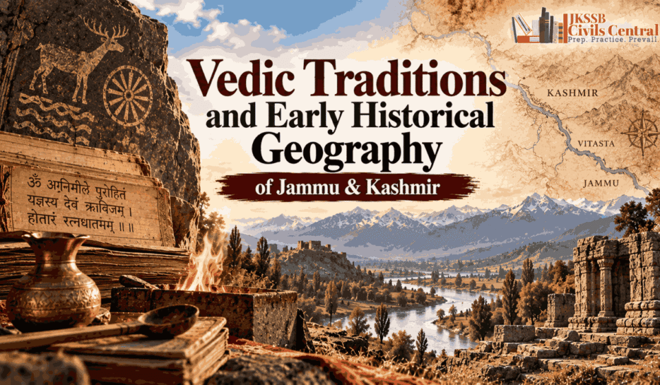
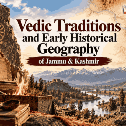
Vedic Traditions and Early Historical Geography of Jammu & Kashmir

J&K History Series Navigation
| Previous Article | Current Article | Next Article |
|---|---|---|
| Article 03 — Megalithic and Early Cultural Developments in Jammu & Kashmir | Article 04 — Vedic Traditions and Early Historical Geography of Jammu & Kashmir | Article 05 — Alexander, Mauryas and the Early Historical Connections of Jammu & Kashmir |
Learning Dashboard
| Component | Key Information |
|---|---|
| Historical Period | Vedic and Early Historical Period |
| Historical Phase | Early textual references and formation of historical geography |
| Main Topic | Vedic traditions, river geography and early references to Kashmir |
| Core Region | Kashmir Valley, Jammu region and the northwestern river system |
| Important Vedic River | Vitasta — Jhelum |
| Other Important Rivers | Asikni — Chenab; Parushni — Ravi; Sindhu — Indus |
| Important Texts | Rigveda, Panini’s Ashtadhyayi, Mahabharata and later Puranic literature |
| Earliest Direct Name “Kashmir” | Generally associated with Panini’s Ashtadhyayi, c. 5th–4th century BCE |
| Important Later Source | Nilamata Purana — much later than the Vedic corpus |
| Core Historical Caution | Vedic mention of a river does not automatically prove political control or settlement throughout modern J&K |
| JKSSB Importance | Very High |
| Main Question Types | River identification, source identification, chronology, statement-based, textual geography |
Introduction
The transition from the prehistoric archaeological record to the early historical geography of Jammu & Kashmir requires a change in the type of evidence being examined. Previous Articles dealts primarily with archaeological evidence—settlements, tools, agriculture, burials, menhirs and material culture. This Article introduces textual geography, particularly the appearance of rivers, regions and peoples in early Sanskrit literature and related traditions.
The most important Vedic geographical connection with the territory of present-day Jammu & Kashmir is the Vitasta, identified with the modern Jhelum. The Rigveda’s famous river hymn, the Nadi-Stuti Sukta (Rigveda 10.75), names Vitasta alongside several major rivers of the northwestern subcontinent. The same geographical environment also included rivers later identified with the Asikni (Chenab) and Parushni (Ravi).
However, an important distinction must be made at the outset. The appearance of a river in Vedic literature does not mean that the entire modern territory of Jammu & Kashmir formed a Vedic political unit. Nor does it establish that every part of the Kashmir Valley was directly occupied or governed by Vedic communities. The evidence is better understood as showing that the river systems connecting the northwestern subcontinent included geographical features associated with areas that later became central to the history of Jammu & Kashmir.
The direct textual appearance of the name Kashmir/Kaśmīra belongs to a later stage of textual history. A recent scholarly study places the earliest extant Sanskrit textual reference to Kashmir in Panini’s Ashtadhyayi, generally dated to the fifth–fourth centuries BCE, while also noting later references in the Mahabharata and Puranic literature.
CivilsCentral Historical Insight: The early history of Jammu & Kashmir cannot be reconstructed from a single textual tradition. The strongest approach is to connect archaeology → river geography → early textual references → later historical sources, while carefully distinguishing evidence for a geographical connection from evidence for a political or cultural identity.
Part I — The Geographical Setting Before Historical States
1. Geography as the Foundation of Early History
The physical geography of Jammu & Kashmir played a major role in shaping its early historical connections. The region is situated within the northwestern Himalayan system, with major river valleys providing routes through otherwise difficult mountain terrain. The Kashmir Valley is drained primarily by the Jhelum, while the Jammu region is connected to the Chenab and Ravi systems and to the wider Punjab plains.
This geography meant that the region was neither completely isolated nor simply an extension of the plains. Mountain passes, river valleys and intermontane routes created selective channels of communication. Communities moving through the northwestern subcontinent could therefore interact with the Himalayan valleys without requiring the entire mountain region to share a single political or cultural system.
This is particularly important when reading early Sanskrit texts. Ancient geographical descriptions often organize space through rivers, mountains, peoples and regions, rather than through modern territorial boundaries.
Part II — The Vedic Geographical Horizon
2. The Sapta-Sindhu and the Northwestern World
The geographical horizon of the early Vedic corpus is strongly associated with the northwestern part of the Indian subcontinent. One of the most important concepts for understanding this geography is Sapta-Sindhu, commonly rendered as the “land of the seven rivers.”
The Rigvedic river geography is particularly valuable because rivers are named individually rather than simply being described as abstract geographical features. This allows historians to compare ancient hydronyms with later and modern river names.
The northwestern river system included the Indus and several of its major tributaries. Among these was Vitasta, the ancient name generally identified with the Jhelum. The Rigveda’s Nadi-Stuti hymn places Vitasta among a group of major rivers, demonstrating that the river was known within the geographical world represented by the Vedic text.
CivilsCentral Historical Insight: For examination purposes, the key connection is Vedic geographical awareness, not modern political boundaries. The safest historical statement is that the Rigveda preserves the name Vitasta for the river identified with the Jhelum; it is much less defensible to claim that the entire present-day J&K was a Vedic political unit.
Part III — Vitasta: The Jhelum in Vedic Geography
3. Vitasta and the Jhelum
The Vitasta is one of the most important river names for the early history of Kashmir. It is generally identified with the modern Jhelum, the principal river flowing through the Kashmir Valley.
The river enters the historical geography of Kashmir at several levels. In the earliest textual layer relevant to this article, it appears in the Rigvedic river list. In later Sanskrit literature, the river becomes increasingly integrated into the sacred and historical geography of Kashmir.
The Jhelum’s physical importance is equally significant. It flows through the Kashmir Valley and connects the valley with the wider Indus drainage system. The Central Ground Water Board identifies the Jhelum as the principal drainage system of the Kashmir Valley and records Vitasta as its Sanskrit name.
The river therefore provides a useful example of continuity between physical geography and historical memory. A geographical feature known in early textual traditions remained central to the later cultural and religious geography of Kashmir.
4. The Rigvedic River Hymn
The most important Vedic passage for the study of Kashmir’s early geographical connections is Rigveda 10.75, commonly known as the Nadi-Stuti Sukta, or Hymn to the Rivers.
The hymn names a sequence of rivers including:
Ganga → Yamuna → Sarasvati → Shutudri → Parushni → Asikni → Vitasta
It subsequently refers to the Sindhu and other rivers of the northwestern system.
For J&K history, three names are especially important:
| Vedic Name | Modern Identification | Examination Importance |
|---|---|---|
| Vitasta | Jhelum | Highest |
| Asikni | Chenab | High |
| Parushni | Ravi | High |
| Sindhu | Indus | High |
These identifications are among the most useful river-name associations for J&K-specific examination preparation.
Part IV — Asikni and Parushni: The Wider Jammu Connection
5. Asikni — The Chenab
The Asikni is generally identified with the Chenab. The river is particularly important for understanding the wider geographical environment of the Jammu region. The Chenab rises through the union of the Chandra and Bhaga streams and eventually flows through the western Himalayan and Jammu-related landscape before entering the plains. Modern government geographical material identifies the ancient Vedic name Asikni with the Chenab.
The importance of this association lies in demonstrating that early Vedic river geography was not limited to the Kashmir Valley’s Jhelum basin. The broader northwestern river system connected the Himalayan foothills and valleys with the Punjab plains.
However, the presence of the Asikni in Vedic literature should not be used to claim that the entire modern Jammu region constituted a single Vedic polity. River geography and political geography are different categories.
6. Parushni — The Ravi
The Parushni is generally identified with the modern Ravi. The Ravi flows through the western Himalayan region before entering the Punjab plains. In Vedic geographical literature, Parushni forms part of the river system associated with the northwestern Vedic world.
The river is also associated in Vedic literature with the famous conflict traditionally known as the Battle of the Ten Kings, or Daśarājña, involving Sudas and a coalition of opposing groups. This event belongs to the wider history of the northwestern Vedic world rather than specifically to the political history of the Kashmir Valley.
For J&K history, its significance is geographical: the river system around Jammu was connected to the wider northwestern landscape represented in early Vedic texts.
Part V — What the Vedic Evidence Actually Proves
7. Evidence vs Historical Inference
The Vedic references to rivers are valuable, but they must be interpreted carefully.
The evidence strongly establishes:
- Vitasta was known by that name in the Rigvedic textual tradition.
- Vitasta is generally identified with the Jhelum.
- Asikni is generally identified with the Chenab.
- Parushni is generally identified with the Ravi.
- These rivers belonged to the broader northwestern river geography represented in early Sanskrit literature.
The evidence does not automatically establish:
- that the modern Union Territory of J&K existed as a political unit;
- that a single Vedic kingdom controlled the entire region;
- that all inhabitants of the Kashmir Valley were Vedic communities;
- that every archaeological development in prehistoric Kashmir was caused by Vedic migration;
- that later Puranic traditions can be projected unchanged onto the Vedic period.
CivilsCentral Historical Insight: A textual reference is evidence of knowledge, not automatically evidence of political control. The appearance of Vitasta in the Rigveda establishes an early textual awareness of the river, but the political history of Kashmir must be reconstructed from additional archaeological, textual and later historical evidence.
Part VI — Was Kashmir Directly Mentioned in the Vedas?
8. Kashmir and the Vedic Corpus
One of the most important examination distinctions is between Vitasta and Kashmir. The Rigveda mentions Vitasta, but the direct name Kaśmīra/Kashmir belongs to a later textual horizon. Scholarly discussions generally place the earliest extant Sanskrit textual reference to the name Kashmir in the Ashtadhyayi of Panini, rather than in the Rigveda.
This means that the statement: “The Rigveda directly mentions Kashmir by name”, should not be treated as an established fact.
The more precise statement is: The Rigveda mentions Vitasta, identified with the Jhelum, while the direct textual occurrence of the name Kaśmīra is associated with the later grammatical tradition of Panini.
9. Why This Distinction Matters
The difference between a river name and a regional name may appear minor, but it is historically significant. A river can be known to communities outside the territory through travel, exchange or geographical awareness. A regional name, by contrast, provides stronger evidence for recognition of a particular territorial or cultural unit.
Therefore, historians distinguish between: Early geographical awareness of the Vitasta and Later textual identification of Kaśmīra as a region and people.
This allows the chronology of textual evidence to be reconstructed without forcing later terminology into earlier periods.
Part VII — Panini and the Emergence of Kaśmīra
10. Panini’s Ashtadhyayi
The next major stage in the textual geography of Kashmir is associated with Panini, the great Sanskrit grammarian traditionally dated to around the fifth–fourth centuries BCE. Panini’s Ashtadhyayi is primarily a work on Sanskrit grammar rather than a geographical chronicle. Yet its treatment of place names, peoples and linguistic formations provides valuable information about the geographical world known to the grammatical tradition.
The Kaśmīra name appears in the grammatical tradition associated with Panini. Modern scholarship identifies references in the Ganapatha associated with Paninian sutras, including IV.2.133 and IV.3.93.
The significance is considerable because the name now appears not merely as a river but as a regional designation.
This marks an important transition:
Vitasta → geographical feature
Kaśmīra → named region
The distinction helps explain why Panini is important for the early historical geography of Kashmir.
11. Panini’s Geographical World
Panini’s geographical information extends far beyond Kashmir. His grammatical material preserves names associated with a wide geographical zone stretching across northwestern and northern South Asia. The Paninian tradition includes names such as:
- Sindhu
- Gandhara
- Kamboja
- Darada
- Kaśmīra
- Salva
- Kuru
- and other regional designations.
The geographical information preserved in Panini is important because place names were embedded in linguistic rules and therefore provide indirect evidence about the geographical and social world in which the grammatical tradition operated. V. S. Agrawala’s study of Panini emphasizes the exceptional geographical value of the Ashtadhyayi and its associated grammatical material.
However, Panini should not be treated as a conventional historian. His work was not written to narrate the political history of Kashmir.
CivilsCentral Historical Insight: Panini is important to J&K history not because he wrote a history of Kashmir, but because his grammatical tradition preserves geographical names that help historians reconstruct the wider political and cultural map of northwestern South Asia.
Part VIII — Kashmir and the Mahabharata Tradition
12. Kashmir in the Mahabharata
The Mahabharata contains references to Kashmir and the people associated with the region. Later scholarly studies identify references to Kashmir in passages dealing with the geography and peoples of Bharatavarsha, including the Aranyaka and Bhishma sections.
These references are important for understanding the expanding literary conception of northern and northwestern regions. However, the Mahabharata is a layered text whose composition and transmission extended over a long period. It should therefore not be treated as though every geographical reference belongs to one precisely datable historical moment.
The Mahabharata’s references to Kashmir are valuable as evidence of the region’s place in later Sanskrit geographical imagination, but they must be distinguished from contemporary administrative records or archaeological evidence.
13. Kashmir, Gandhara, Kamboja and the Northern Frontier
The Mahabharata and other early Sanskrit traditions frequently place Kashmir within a larger northern geographical world that includes regions and peoples such as Gandhara, Kamboja and Darada. This is historically significant because Kashmir was not imagined in isolation. Its position within the northwestern mountain world connected it to trans-Himalayan and northwestern routes.
At the same time, identifying the exact location and territorial extent of ancient peoples such as the Kambojas and Daradas can be debated. Different scholars have proposed different geographical boundaries, and these should not be converted into absolute modern territorial equivalents.
The important historical conclusion is therefore broader:
Kashmir formed part of a wider northwestern geographical network.
Part IX — Daradas and the Northern Mountain World
14. The Daradas
The Daradas are an important people in the historical geography of the northwestern Himalayan region. Ancient Indian texts associate them with the northern and northwestern mountain areas beyond or around Kashmir. Panini’s grammatical tradition also preserves the name Darada, demonstrating that the name belonged to the geographical vocabulary of the northwestern world.
Later historical geography generally associates the Darada region with areas to the north of Kashmir, particularly the broader Indus and upper mountain zones. However, the exact boundaries of the ancient Darada territory cannot simply be equated with the borders of any modern administrative region. This distinction is important because early geographical names often referred to peoples and cultural zones rather than precisely surveyed territorial states.
Part X — The Kambojas and the Northwestern Connections
15. Kamboja in Early Historical Geography
The Kambojas occupy an important position in the ancient geography of the northwestern subcontinent. They appear in early Sanskrit and later Buddhist traditions and are frequently associated with the wider northwestern frontier. Their precise geographical location is debated, and different periods may have used the name in different ways.
For the history of Jammu & Kashmir, Kamboja is relevant because some historical-geographical interpretations place Kamboja-related territories in proximity to the southwestern and northwestern approaches to Kashmir. But this should be presented cautiously rather than as a settled equation between Kamboja and a particular modern district.
The safer examination association is:
Kamboja → northwestern frontier, rather than: Kamboja = one fixed modern region
Part XI — From Vedic Geography to Early Historical Geography
16. A Changing Geographical Vocabulary
The textual geography of the region developed gradually. A broad chronological progression can be represented as:
Vedic River Geography
↓
Vitasta / Asikni / Parushni
↓
Paninian Geographical Vocabulary
↓
Kaśmīra + Darada + Gandhara + Kamboja
↓
Epic and Puranic Geographies
↓
Later Kashmir-specific Sanskrit traditions
This does not mean that each stage completely replaced the previous one. Older geographical names continued to be used even as new territorial and cultural descriptions developed.
The historical importance of this progression lies in the increasing specificity with which Kashmir and its neighbouring regions appear in textual geography.
Part XII — The Nilamata Purana: A Later Kashmir-Specific Tradition
17. Why the Nilamata Purana Must Not Be Called a Vedic Text
The Nilamata Purana occupies a major position in the cultural and sacred geography of Kashmir, but it belongs to a much later period than the Vedic corpus. Scholarly research generally places the composition of the text around the early medieval period, with scholarship variously associating its principal composition with the seventh century or the seventh–eighth centuries, while also recognizing the possibility of later interpolations.
Therefore, the Nilamata Purana should not be used as direct evidence for the Vedic period. Its historical importance is different: it provides evidence for a developed Kashmir-specific sacred and cultural tradition in Sanskrit literature.
The text discusses the region’s rivers, lakes, springs, sacred places, festivals, rituals, deities and religious practices. In doing so, it connects the physical landscape of Kashmir with a sacred narrative framework. Geography is therefore not merely described as physical space; particular places and natural features acquire religious and cultural significance.
CivilsCentral Historical Insight: The Nilamata Purana is valuable for understanding the religious geography and cultural traditions of Kashmir, but its chronological distance from the Vedic corpus means that it should not be treated as a contemporary source for Vedic-era Kashmir.
18. Satisara: The Traditional Lake of Kashmir
One of the most important traditions associated with Kashmir’s origin concerns Satisara, described in the traditional literature as a vast lake that once occupied the Kashmir Valley.
According to the tradition, the valley was covered by water and could not be inhabited in its later form. The story of its transformation is connected with Kashyapa, who, according to the traditional account, caused the waters to be drained, thereby making the land habitable. This narrative became an important component of Kashmir’s traditional conception of its own geographical origins.
The Satisara narrative should, however, be treated as a literary and sacred tradition, not as a straightforward geological or archaeological report. The Kashmir basin does have a well-established geological history involving ancient lakes and large bodies of water, but geological evidence does not by itself establish the narrative characters, chronology or supernatural events described in the literary tradition.
The distinction is therefore essential:
Satisara tradition → literary and sacred memory
Ancient lake deposits → geological evidence
Historical interpretation → comparison of the two without automatically equating them
19. Jalodbhava: The Demon of Satisara
The Satisara narrative is closely associated with Jalodbhava, a water-associated demon in the traditional account. The name is also encountered in variant forms such as Jalod or Jalod Bawa in popular/local usage, but Jalodbhava is the more appropriate form for an exam-oriented historical discussion of the Sanskrit tradition.
In the traditional narrative, Jalodbhava is associated with the waters of Satisara and represents the principal obstacle to the settlement of the region. The story consequently presents the draining of the lake and the defeat or removal of Jalodbhava as interconnected elements in the transformation of Kashmir from a water-filled landscape into an inhabitable land.
The tradition connects this episode with Kashyapa, whose intervention is presented as decisive in overcoming the obstacle and making the valley habitable. The narrative also belongs to a wider Naga-related sacred tradition associated with Kashmir, in which water bodies, springs, rivers and other geographical features are connected with supernatural beings and sacred communities.
It is important, however, not to read Jalodbhava as an independently verified historical person or as evidence of an actual supernatural event. Jalodbhava belongs to the mythological and literary layer of Kashmir’s historical tradition.
CivilsCentral Historical Insight: Jalodbhava should be understood within the symbolic structure of the Satisara narrative. The story links water, landscape, settlement and sacred intervention, thereby providing a traditional explanation for the transformation of the Kashmir Valley.
Kashyapa, the Draining of Satisara and the Formation of Kashmir in Tradition
The three elements — Satisara, Jalodbhava and Kashyapa — therefore form a connected narrative rather than three unrelated traditions.
In its broad traditional structure, the story presents Satisara as the primordial lake, Jalodbhava as the water-associated obstacle, and Kashyapa as the figure whose intervention makes the land habitable. The draining of the waters consequently becomes the central event through which the traditional landscape of Kashmir is explained.
The story is particularly important because it does more than explain a geographical feature. It establishes a relationship between landscape and sacred history. Mountains, lakes, springs, rivers and settlements become part of a remembered sacred past, while the transformation of the landscape is attributed to figures belonging to the religious tradition.
The Naga tradition is also significant in this context. Kashmir’s ancient religious traditions attached considerable importance to water sources and serpent/Naga-associated sacred places. The Satisara narrative should therefore be understood within this broader cultural environment rather than as an isolated story about the origin of the valley.
Kalhana’s Rajatarangini, written centuries later, also preserves the traditional account of Kashmir’s early past and incorporates the Satisara–Kashyapa narrative into its opening historical framework. This demonstrates the continuity and transmission of the tradition across Kashmir’s Sanskrit historical literature.
Satisara, Geology and the Limits of Historical Interpretation
The Satisara tradition becomes especially interesting when considered alongside the geological history of the Kashmir Valley. Geological research has established that the Kashmir basin experienced major phases of lacustrine deposition and that large bodies of water existed in the region in the geological past.
This provides an important point of comparison, but not proof of the legend. Geological processes operate on timescales and through mechanisms that cannot simply be mapped onto the chronology of Sanskrit literary traditions. The existence of ancient lake deposits therefore cannot establish that a particular lake called Satisara existed exactly as described in the literary narrative, nor can geology verify Jalodbhava or Kashyapa’s role in draining it.
A historically responsible interpretation therefore keeps the evidence categories separate:
| Evidence | What it can establish |
|---|---|
| Nilamata Purana | Literary evidence for Kashmir’s sacred geography and traditions |
| Rajatarangini | Evidence for the preservation and transmission of Kashmir’s historical traditions |
| Geological evidence | Physical evidence concerning ancient lakes and environmental history |
| Archaeological evidence | Evidence concerning human settlement and material culture |
| Traditional narrative | Evidence of cultural memory, sacred geography and historical imagination |
CivilsCentral Historical Insight: The geological existence of ancient lakes in Kashmir may provide a meaningful context for the Satisara tradition, but context is not proof. Historical interpretation must not convert a possible environmental memory into a demonstrated historical event.
Satisara and the Name Kashmir
Later tradition also connects the formation of Kashmir with the sage Kashyapa, particularly through the story of draining Satisara. Traditional explanations have attempted to associate the name Kashmir with Kashyapa-related etymologies. Such explanations are culturally important and form part of Kashmir’s traditional historical consciousness, but they should not automatically be presented as linguistically established explanations without specialist philological evidence.
For examination purposes, the safest distinction is:
Traditional origin narrative → Kashyapa and the draining of Satisara
Historical-linguistic evidence → Kaśmīra as an early textual regional name
The two belong to different categories of evidence. The first explains Kashmir’s origins within a sacred literary tradition; the second concerns the historical development and attestation of the region’s name.
Historical Significance of the Satisara–Jalodbhava Tradition
The Satisara–Jalodbhava–Kashyapa narrative is important for the study of Kashmir not because it provides a literal documentary account of the valley’s geological formation, but because it reveals how Kashmir’s landscape was incorporated into a coherent sacred historical tradition.
The narrative connects environmental features with religious memory, explains the transformation of the landscape through sacred agency, and places Kashmir within a wider Sanskritic and Naga-associated cultural framework. Its preservation in Kashmir-specific literature also demonstrates that the region developed distinctive traditions for explaining its own geography and antiquity.
For the historian, therefore, the value of the tradition lies at several levels: it is evidence of cultural memory, evidence of sacred geography, evidence for the development of Kashmir-specific literary traditions, and a useful case study in the distinction between literary narrative and material evidence.
For JKSSB aspirants, the key conceptual point is straightforward:
Satisara = traditional primordial lake
Jalodbhava = water-associated demon in the traditional narrative
Kashyapa = traditional figure associated with draining the lake
Nilamata Purana = important Kashmir-specific Sanskrit source preserving this tradition
Rajatarangini = later historical work that also preserves the Kashmir origin tradition
Geology = independent evidence for the ancient environmental history of the Kashmir basin, not proof of the legend
CivilsCentral Historical Insight: Kashmir’s origin tradition should be studied as historical memory rather than literal geological history. Its significance lies in the way Kashmiri literary traditions transformed the physical landscape into a sacred and historical landscape.
Part XIII — The Geography of Sacred Kashmir
20. From Physical Landscape to Sacred Geography
The later development of Kashmir’s textual traditions demonstrates a transformation in the meaning of geographical space. Rivers such as the Vitasta were no longer simply waterways. They became sacred entities associated with rituals, pilgrimage and religious memory. Lakes, springs, mountains and confluences similarly became components of a sacred geography.
The Nilamata Purana is particularly important for this process. Modern scholarship describes it as a text that helped reconstruct Kashmir’s local geography within a broader Sanskritic sacred geography. This development should not be projected backward into the Rigvedic period. It represents a later historical stage in which local landscapes were increasingly integrated into a specifically Kashmir-centred religious and cultural tradition.
Part XIV — What About Jammu?
21. Jammu in Early Historical Geography
The history of Jammu requires particular caution because the modern political identity of Jammu is much later than the early textual traditions examined here. The early sources do not present a neatly bounded territory called “Jammu and Kashmir” corresponding to the modern Union Territory.
Instead, the geographical landscape around present-day Jammu was connected to the larger systems of:
- Ravi;
- Chenab;
- Punjab plains;
- Himalayan foothills;
- northwestern frontier regions.
The Asikni/Chenab and Parushni/Ravi therefore provide important geographical connections for understanding the region. But these river associations do not by themselves establish a distinct “Jammu kingdom” in the Vedic period.
This is a critical series-wide safeguard: modern territorial names and political boundaries must not be projected backward without evidence.
Part XV — Historical Geography and Archaeology: Two Different Evidence Systems
22. Archaeology vs Textual Tradition
The first three articles in this series established prehistoric developments primarily through archaeology. These two evidence systems answer different questions.
Archaeology can reveal:
- settlements;
- material culture;
- agriculture;
- burials;
- monuments;
- tools;
- environmental adaptation;
- chronology through scientific dating.
Textual evidence can reveal:
- names of rivers;
- names of peoples;
- geographical concepts;
- sacred traditions;
- regional identities;
- literary perceptions of space.
Neither should automatically replace the other. A river named in a text does not prove a specific settlement at a particular archaeological site. Similarly, archaeological evidence cannot by itself tell us what a community called a river unless textual or linguistic evidence is available.
CivilsCentral Historical Insight: The transition from prehistoric to early historical study is not simply a transition from “fact” to “story.” It is a transition toward multiple evidence systems, each with its own strengths and limitations.
Part XVI — The Historical Geography of Early Kashmir
23. Kashmir as a Mountain Valley
The physical structure of Kashmir shaped its historical position. The valley is enclosed by mountain systems but contains a major river corridor through the Jhelum. This combination created both protection and connectivity.
The mountains limited easy movement from the plains, while passes and river routes allowed controlled interaction with neighbouring regions. This helps explain why Kashmir could develop distinctive local cultural traditions while remaining connected to the wider northwestern world.
The geographical position also made Kashmir relevant to routes leading toward Gandhara, the upper Indus and the Himalayan regions. Thus, the historical geography of Kashmir is best understood through the tension between:
Relative geographical enclosure and Regional connectivity.
Part XVII — The Importance of Rivers in Early Historical Geography
24. Rivers as Historical Markers
In early Indian geographical traditions, rivers were not merely physical features. They often served as markers of territories, cultural zones and sacred landscapes. For Kashmir, the Vitasta was especially important because it linked the valley to the wider Indus system. For Jammu and the adjoining Himalayan foothills, the Chenab and Ravi provided connections to the Punjab plains.
This means that river geography can help historians reconstruct the direction of interaction even when political boundaries remain uncertain. The rivers therefore provide one of the strongest bridges between the archaeological landscape of prehistoric J&K and the textual geography of early historical India.
Part XVIII — From Kaśmīra to a Distinct Historical Region
25. The Emergence of a Named Region
The appearance of Kaśmīra in the Paninian grammatical tradition represents an important stage in the textual history of the region. The significance is not that Kashmir suddenly “came into existence” at this point. The archaeological record demonstrates much earlier human occupation. Rather, the Paninian evidence shows that the region had acquired a recognizable geographical name within an early Sanskrit textual tradition.
This distinction is fundamental:
Human settlement in Kashmir → prehistoric and archaeological evidence
Kaśmīra as a named region → early textual evidence
These are different historical questions.
Part XIX — The Limits of Vedic Political Reconstruction
26. Was There a Vedic Kingdom of Kashmir?
There is insufficient evidence to describe the Kashmir Valley of the Rigvedic period as a clearly documented Vedic kingdom corresponding to the later historical state of Kashmir. The Rigveda gives us valuable river geography, particularly the Vitasta, but it does not provide a continuous political history of Kashmir. Later textual sources mention Kashmir more directly, but they too must be dated and interpreted according to their own historical contexts.
Therefore, the responsible conclusion is:
Vedic literature provides an important geographical horizon for understanding the northwestern environment connected to Jammu & Kashmir, but it does not provide a continuous political history of the region.
Part XX — Historical Interpretation and Evidence Levels
27. Evidence Classification
| Evidence Level | Claim |
|---|---|
| A — Strongly Established | Rigveda 10.75 contains the name Vitasta |
| A — Strongly Established | Vitasta is generally identified with the Jhelum |
| A — Strongly Established | Asikni is generally identified with the Chenab |
| A — Strongly Established | Parushni is generally identified with the Ravi |
| A — Strongly Established | The Paninian grammatical tradition contains Kaśmīra |
| B — Strong Historical Interpretation | Early textual geography places Kashmir within a wider northwestern geographical network |
| B — Strong Historical Interpretation | Panini’s geographical material is valuable for reconstructing early regional geography |
| C — Literary / Traditional | Kashyapa drained the primordial lake Satisara |
| C — Literary / Traditional | The Satisara narrative represents the literal historical formation of Kashmir |
| D — Contested | Exact geographical boundaries of several ancient peoples such as Kamboja |
| D — Contested | Directly equating later sacred geography with the Vedic geographical world |
Part XXI — JKSSB Knowledge Matrix
28. High-Value Associations
| Question Area | Answer |
|---|---|
| Vitasta | Jhelum |
| Asikni | Chenab |
| Parushni | Ravi |
| Sindhu | Indus |
| Nadi-Stuti Sukta | Rigveda 10.75 |
| Kaśmīra | Early textual regional name in Paninian tradition |
| Panini | Ashtadhyayi |
| Mahabharata | Later epic references to Kashmir |
| Nilamata Purana | Later Kashmir-specific sacred geography |
| Satisara | Legendary primordial lake of Kashmir |
| Kashyapa | Associated in tradition with draining Satisara |
| Vitasta | Central river of Kashmir |
| Darada | Northwestern/northern mountain region |
| Kamboja | Northwestern frontier tradition |
| Core caution | Vedic river reference ≠ proof of a Vedic political state |
Part XXII — Examination Discrimination Points
29. Vitasta vs Asikni vs Parushni
This is one of the highest-value factual distinctions.
Vitasta → Jhelum
Asikni → Chenab
Parushni → Ravi
Sindhu → Indus
30. Rigveda vs Panini
Rigveda
→ Vitasta appears in the river geography.
Panini
→ Kaśmīra appears in the grammatical/geographical tradition.
Therefore:
Rigveda → River
Panini → Named Region
31. Vedic Tradition vs Nilamata Purana
Vedic literature → Early textual horizon
Nilamata Purana → Much later Kashmir-specific Sanskrit tradition
Therefore, the Nilamata Purana should not be described as a Vedic text.
32. Tradition vs Evidence
Kashyapa drained Satisara → Literary/sacred tradition
Large ancient water bodies existed in the Kashmir basin → Geological evidence
The two can be studied together, but one should not be presented as direct proof of the other.
Part XXIII — JKSSB Question-Type Mapping
Direct Fact
Which Vedic river is identified with the modern Jhelum?
Answer: Vitasta
Statement-Based
Consider the following statements:
- The Rigveda mentions Vitasta.
- Vitasta is identified with the Jhelum.
- The Rigveda directly names the political state of Kashmir.
Correct answer: Statements 1 and 2 only.
Match the Following
| Ancient Name | Modern River |
|---|---|
| Vitasta | Jhelum |
| Asikni | Chenab |
| Parushni | Ravi |
| Sindhu | Indus |
Chronology
Arrange the following broadly according to the textual history discussed in this article:
- Paninian geographical tradition
- Rigvedic river geography
- Later Kashmir-specific Sanskrit traditions
Answer:
Rigvedic river geography → Paninian tradition → Later Kashmir-specific Sanskrit traditions
Identification by Clues
Clues:
- Sanskrit grammatical work
- Geographical information embedded in linguistic rules
- Contains the name Kaśmīra
- Generally dated to the fifth–fourth centuries BCE
Answer: Panini’s Ashtadhyayi
Part XXIV — JKSSB Practice Questions
MCQ 1
The ancient name Vitasta is generally identified with:
A. Chenab
B. Ravi
C. Jhelum
D. Tawi
Answer: C. Jhelum
Explanation: Vitasta is the Sanskrit/Vedic name associated with the Jhelum.
MCQ 2
The Nadi-Stuti Sukta is found in:
A. Rigveda 1.1
B. Rigveda 10.75
C. Atharvaveda 10.75
D. Samaveda 10.75
Answer: B. Rigveda 10.75
MCQ 3
Consider the following pairs:
- Vitasta — Jhelum
- Asikni — Chenab
- Parushni — Ravi
- Sindhu — Indus
Which of the pairs are correctly matched?
A. 1 and 2 only
B. 1, 2 and 3 only
C. 2, 3 and 4 only
D. 1, 2, 3 and 4
Answer: D
MCQ 4
Which one of the following best distinguishes the Rigvedic evidence from the Paninian evidence?
A. Rigveda mentions Kashmir as a political kingdom, while Panini does not mention it.
B. Rigveda provides river geography including Vitasta, while the Paninian tradition preserves the name Kaśmīra.
C. Rigveda discusses the Nilamata Purana, while Panini discusses Satisara.
D. Both sources are medieval accounts of Kashmir.
Answer: B
MCQ 5
Consider the following statements:
- The Rigveda directly names Kashmir as a political state.
- The Rigveda mentions Vitasta.
- Paninian grammatical tradition contains the name Kaśmīra.
Which is correct?
A. 1 only
B. 2 only
C. 2 and 3 only
D. 1, 2 and 3
Answer: C
MCQ 6
The Asikni of early Sanskrit/Vedic geographical tradition is generally identified with the:
A. Ravi
B. Jhelum
C. Chenab
D. Beas
Answer: C
MCQ 7
Which of the following should be classified primarily as a later Kashmir-specific sacred-geographical tradition rather than as Vedic literature?
A. Nadi-Stuti Sukta
B. Nilamata Purana
C. Rigvedic river hymn
D. Early Vedic river geography
Answer: B
MCQ 8
The story of Kashyapa draining the primordial lake Satisara is best treated as:
A. A contemporary archaeological report
B. A documented Vedic political event
C. A later literary and sacred tradition
D. A Mauryan administrative record
Answer: C
MCQ 9
Which statement is most historically appropriate?
A. The mention of Vitasta proves that the modern Union Territory of J&K was a Vedic kingdom.
B. The Rigveda provides an early textual reference to a river associated with Kashmir’s geography.
C. The Nilamata Purana is the earliest Vedic source for Kashmir.
D. Panini wrote a political history of Kashmir.
Answer: B
MCQ 10
The earliest extant Sanskrit textual reference to the name Kaśmīra is generally associated with:
A. Rigveda
B. Panini’s Ashtadhyayi
C. Arthashastra
D. Rajatarangini
Answer: B
Part XXV — Rapid Revision Zone
Important Texts
Rigveda → Early Vedic river geography
Panini’s Ashtadhyayi → Early textual evidence for Kaśmīra
Mahabharata → Later epic references to Kashmir and northern peoples
Nilamata Purana → Later Kashmir-specific sacred geography
Important Rivers
Vitasta → Jhelum
Asikni → Chenab
Parushni → Ravi
Sindhu → Indus
Important Sequence
Vedic River Geography
↓
Vitasta
↓
Paninian Geographical Tradition
↓
Kaśmīra as a Named Region
↓
Epic and Puranic References
↓
Nilamata Purana
↓
Later Kashmir Historical Traditions
Important Personalities / Names
Panini → Ashtadhyayi
Kashyapa → Satisara tradition
Nila → Nilamata tradition
Important Concepts
Sapta-Sindhu → Northwestern river geography
Vitasta → Jhelum
Kaśmīra → Named region in early grammatical tradition
Satisara → Legendary primordial lake
Sacred Geography → Later transformation of physical landscape into a religious-cultural landscape
Part XXVI — Frequently Confused Facts
33. Vitasta Is Not the Chenab
Vitasta = Jhelum
Asikni = Chenab
34. Rigveda Does Not Equal Direct Kashmir State History
The Rigveda provides river geography, including Vitasta. It does not provide a continuous political history of Kashmir.
35. Panini Was Not a Historian of Kashmir
Panini’s importance comes from the geographical and social information embedded in his grammatical tradition.
36. Nilamata Purana Is Not Vedic
The Nilamata Purana belongs to a much later historical period and represents Kashmir-specific Sanskrit sacred geography.
37. Satisara Is a Tradition, Not a Literal Historical Record
The Satisara narrative is important for cultural history but should not be presented as a contemporary geological or political account.
38. Ancient Kashmir ≠ Modern J&K Boundaries
Ancient geographical references should not be mapped mechanically onto the present-day Union Territory.
Part XXVII — What Can JKSSB Ask?
39. High-Value Question Areas
From this article, JKSSB can test:
- Vitasta–Jhelum association;
- Asikni–Chenab association;
- Parushni–Ravi association;
- Sindhu–Indus association;
- Rigveda 10.75;
- Nadi-Stuti Sukta;
- Sapta-Sindhu;
- Panini and Kaśmīra;
- Ashtadhyayi;
- Mahabharata references;
- Darada and Kamboja;
- Nilamata Purana;
- Satisara tradition;
- Kashyapa tradition;
- Vedic vs later textual evidence;
- archaeology vs textual geography;
- established evidence vs literary tradition;
- chronology of sources.
The highest-value examination skill is distinguishing the period and evidentiary status of each source.
Part XXVIII — Historical Significance
40. Why Does This Article Matter?
The historical significance of early textual geography lies in the gradual emergence of Kashmir as a recognizable geographical and cultural region within wider South Asian traditions.
The Rigvedic reference to Vitasta demonstrates that the river associated with Kashmir formed part of the geographical vocabulary of the early northwestern textual world. The later appearance of Kaśmīra in the Paninian tradition represents a more explicit recognition of the region as a named geographical entity. Subsequent epic and Puranic traditions increasingly incorporated Kashmir into broader descriptions of the northern regions of Bharatavarsha.
The later Nilamata Purana represents another stage altogether: the transformation of Kashmir’s physical landscape into a highly developed sacred geography centred on rivers, lakes, springs, pilgrimage sites and regional traditions.
The historical process can therefore be understood as:
Physical landscape
↓
River geography
↓
Named regions and peoples
↓
Epic geographical imagination
↓
Kashmir-specific sacred geography
This is not a single event. It is a long process through which geography acquired increasingly specific cultural and historical meanings.
CivilsCentral Historical Insight: The importance of early textual geography lies in showing how Kashmir moved from being identifiable through a major river system to becoming a named region with its own textual and sacred geography. This development provides an essential bridge between prehistoric archaeology and the historical Kashmir of later sources.
Part XXIX — Chapter Summary
The early history of Jammu & Kashmir cannot be reconstructed simply by searching ancient texts for the modern name of the region. The evidence develops gradually and must be read according to the chronology and nature of each source.
The Rigveda provides the earliest important textual geographical connection through the Vitasta, identified with the modern Jhelum. Its Nadi-Stuti hymn also refers to other rivers of the northwestern system, including the Asikni and Parushni, identified with the Chenab and Ravi respectively.
This river geography should not be converted into evidence for a Vedic political state corresponding to modern Jammu & Kashmir. It demonstrates geographical knowledge and connection rather than a clearly documented political boundary. A more explicit regional name appears in the Paninian grammatical tradition, where Kaśmīra occurs among geographical names. Modern scholarship generally places the composition of Panini’s work in the fifth–fourth centuries BCE.
The Mahabharata and later Puranic traditions contain further references to Kashmir, its people and its geographical position, although their layered textual histories require caution in assigning precise dates to individual passages.
Much later, the Nilamata Purana developed a distinctly Kashmir-centred sacred geography. Its traditions concerning the Vitasta, Satisara, Kashyapa, sacred springs and pilgrimage sites demonstrate how the physical landscape was incorporated into a regional religious and cultural framework.
JKSSB Takeaway
Remember the core chain:
Vitasta → Jhelum
Asikni → Chenab
Parushni → Ravi
Rigveda 10.75 → Nadi-Stuti
Panini → Kaśmīra
Nilamata Purana → Kashmir-specific sacred geography
Part XXX — Mind Map
41. Vedic Traditions and Early Historical Geography of J&K
PREHISTORIC BACKGROUND
Archaeological settlements
↓
Neolithic culture
↓
Megalithic developments
↓
VEDIC GEOGRAPHY
Sapta-Sindhu
↓
River System
↓
IMPORTANT RIVERS
Vitasta → Jhelum
Asikni → Chenab
Parushni → Ravi
Sindhu → Indus
↓
TEXTUAL DEVELOPMENT
Rigveda
↓
Panini
↓
Mahabharata
↓
Puranic traditions
↓
NAMED REGION
Kaśmīra
↓
NORTHERN GEOGRAPHICAL NETWORK
Gandhara
Kamboja
Darada
Kaśmīra
↓
LATER KASHMIR-SPECIFIC TRADITION
Nilamata Purana
↓
Vitasta
↓
Satisara
↓
Sacred Springs
↓
Pilgrimage Geography
↓
HISTORICAL INTERPRETATION
Textual evidence
+
Archaeological evidence
+
Geographical evidence
↓
EARLY HISTORICAL KASHMIR
↓
Alexander, Mauryas and Early Historical Connections
FAQs
Q1. Which Vedic river is identified with the Jhelum?
Vitasta.
Q2. Where is Vitasta mentioned?
Vitasta appears in the Nadi-Stuti Sukta of the Rigveda, 10.75.
Q3. What is Asikni?
Asikni is the ancient name generally identified with the Chenab.
Q4. What is Parushni?
Parushni is the ancient name generally identified with the Ravi.
Q5. Does the Rigveda directly mention Kashmir by name?
The safer historical formulation is no: the Rigveda provides an important geographical connection through Vitasta, while the direct textual occurrence of Kaśmīra is generally associated with the Paninian tradition.
Q6. Why is Panini important for Kashmir history?
Panini’s grammatical tradition preserves the name Kaśmīra, providing important early textual evidence for Kashmir as a named region.
Q7. Was Panini a historian?
No. He was primarily a Sanskrit grammarian. His geographical value comes from place names and linguistic information embedded in his grammatical work.
Q8. What is the Nilamata Purana?
It is a later Sanskrit text closely associated with the religious, cultural and sacred geography of Kashmir.
Q9. What is Satisara?
Satisara is the legendary primordial lake of Kashmir described in later Kashmir-specific traditions.
Q10. Did the Vedic texts describe the modern Union Territory of Jammu & Kashmir?
No such modern territorial unit existed in the Vedic period. The texts must be interpreted through their own geographical categories, particularly rivers, peoples and regions.
About The Author




[…] Article 04 — Vedic Traditions and Early Historical Geography of Jammu & Kashmir […]
[…] Article 04 — Vedic Traditions and Early Historical Geography of Jammu & Kashmir […]