
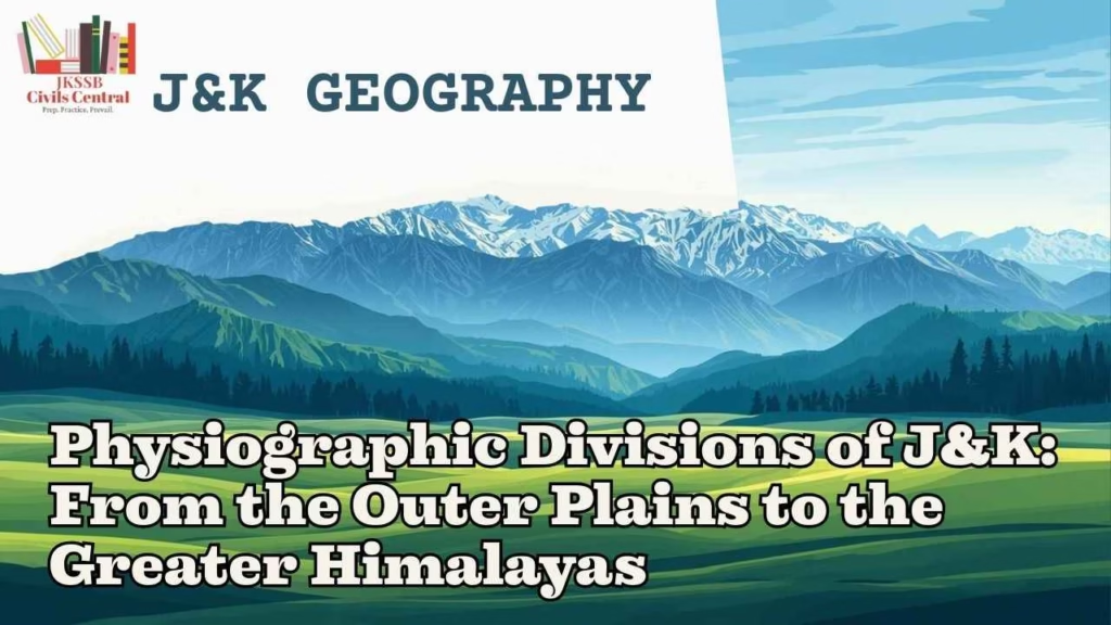
Physiographic Divisions of J&K
The geographical and physiographic framework of the Union Territory of Jammu and Kashmir represents one of the most complex and dynamic terrestrial systems in the northern Indian subcontinent. Situated between the latitudes of 32O17′ and 36O08′N and longitudes of 73O23′ and 76O47′E, this region serves as a vertical cross-section of the Western Himalayan system, transitioning from subtropical alluvial plains to arctic high-altitude massifs. The uniqueness of Jammu and Kashmir’s geography is fundamentally rooted in its tectonic history, where the ongoing collision between the Indian Plate and the Eurasian Plate continues to drive the uplift of the youngest fold mountain system in the world. This geomorphic evolution has produced a diverse array of landforms, including deep gorges, longitudinal valleys, extensive plateaus, and soaring peaks that reach elevations exceeding 7,000 meters.
Administratively, the region underwent a significant transformation on October 31, 2019, with the implementation of the Jammu and Kashmir Reorganisation Act, which transitioned the former state into a Union Territory and separated the Ladakh region into its own distinct administrative entity. Despite this administrative shift, the physiographic links between the regions remain inextricably bound by the mountain ranges that define their borders. The Union Territory covers an area of approximately 42,241 square kilometers, characterized by a rugged mountainous terrain that is subdivided into two primary administrative divisions—Jammu and Kashmir—which are further partitioned into 20 districts.
The structural diversity of the region is reflected in its six distinct physiographic units: the Sirowal and Kandi belts of the Outer Plains, the Shiwalik hills, the Middle Himalayas dominated by the Pir Panjal range, the intermontane Valley of Kashmir, and the Greater Himalayas. These divisions are not merely topographic boundaries but represent different geological epochs and ecological zones, ranging from the Pleistocene deposits of the plains to the ancient Pre-Cambrian cores of the high mountains. Understanding these divisions requires a multifaceted approach that considers geological composition, climatic influences, and the socio-economic impacts of the terrain.
The Outer Plains: The Southern Alluvial Threshold
The southernmost physiographic division of Jammu and Kashmir is the Outer Plains, which constitute a narrow yet vital strip of fertile land that bridges the gap between the Indo-Gangetic plains of the south and the rising Himalayan foothills to the north. These plains represent an extension of the Great Plains of India and are primarily formed by the depositional work of the Chenab, Ravi, Tawi, and their numerous tributaries. Stretching for approximately 110 kilometers from the Ravi River in the east to the Chenab in the west, the width of these plains fluctuates between 5 and 30 kilometers, with an average elevation ranging from 325 to 360 meters above mean sea level.
Regional Nomenclature: Andarwah and Bajwat
The Outer Plains are locally distinguished by specific regional names that emphasize their geographical boundaries and hydrographic influences. The tract of land located between the Ravi and the Chenab, particularly the fertile stretches in the southern parts of Kathua, Akhnoor, R.S. Pura, and Samba, is frequently referred to as “Andarwah” and “Bajwat”. These regions are characterized by rich alluvial deposits that support intensive agriculture, making them the primary agricultural engine of the Jammu division.
Geologically, the plains are composed of fluviatile and sub-aerial formations dating back to the Pleistocene and Recent ages. The soil structure predominantly consists of interlocking sandy alluvial fans, loams, and loess deposited by streams discharging from the foothills. The region is dissected by a series of deep and shallow ravines locally known as “khadds” or “choas”. These khadds are typically dry during the summer and winter but transform into dangerous, fast-flowing torrents during the monsoon season, transporting massive quantities of red silt, pebbles, and shingles from the mountains.
| Region | Primary Rivers | Key Districts | Agricultural Focus |
| Andarwah | Ravi, Tawi | Kathua, Samba | Wheat, Rice, Pulses |
| Bajwat | Chenab, Manawar Tawi | Jammu (R.S. Pura, Akhnoor) | Basmati Rice, Vegetables |
The vegetation in this zone has been significantly altered by human colonization and agricultural expansion. Originally characterized by thorn scrub and coarse grasses like “Khar” (elephantine grass), much of the landscape has been cleared for cultivation. The climate is subtropical, with temperatures in the summer often reaching 45OC to 47OC, while winters remain cool, dropping to 3OC. Approximately 80% of the annual precipitation (roughly 1070 mm) occurs during the southwest monsoon from July to September.
The Kandi and Sirowal Belts
Within the Outer Plains, two distinct sub-zones are recognized based on soil porosity and water availability: the Sirowal belt and the Kandi belt.
- The Sirowal Belt: Covering approximately 1,000 square kilometers, this is the lowermost portion of the plains where the water table is relatively shallow, and the soil is more cohesive, allowing for easier irrigation and farming.
- The Kandi Belt: Situated north of the Sirowal belt and immediately south of the Shiwalik hills, the Kandi belt covers about 1,500 square kilometers. This area is characterized by coarse, porous soil composed of reworked Shiwalik debris, sand, and boulders. The porous nature of the soil leads to a very low water table, making water scarcity a perennial issue. Agriculture in the Kandi region is predominantly rain-fed, and the vegetation is dominated by drought-resistant xerophytic species.
The Shiwaliks: The Outer Himalayan Fold
Rising immediately to the north of the Outer Plains are the Shiwalik Hills, also known as the Outer Himalayas or the Jammu Hills. These hills represent the youngest mountains of the Indian subcontinent and are the first major topographical barrier encountered when moving inland from the plains. The range extends for approximately 200 kilometers between the Ravi and Jhelum rivers, with a width varying from 20 to 50 kilometers.
Geological Composition and Ancient Nomenclature
The term “Shiwalik” is derived from the Sanskrit phrase “Tresses of Shiva,” reflecting the deep cultural integration of these mountains into the regional identity. In ancient literature, the range was referred to as “Upgiri”. Geologically, the Shiwaliks are composed of Tertiary deposits, including poorly consolidated sandstones, clays, silts, and conglomerates that represent the solidified detritus of the rising Himalayas to the north.
The elevation of the Shiwaliks in Jammu and Kashmir ranges between 600 and 1,220 meters above sea level. The hills exhibit a characteristic asymmetry: the southern slopes facing the plains have a relatively gentle gradient but end in steep, almost perpendicular escarpments inward, while the northern slopes are steeper and covered with denser vegetation. This zone is geologically unstable and prone to landslides due to the unconsolidated nature of its sediments.
The “Duns”: Longitudinal Structural Valleys
One of the most defining physiographic features of the Shiwalik region is the presence of “Duns” or “Doons”. These are wide, flat-floored longitudinal valleys located between the Shiwalik range and the Middle Himalayas. These valleys were formed when the rising Shiwaliks obstructed the flow of rivers from the Himalayas, creating temporary lakes. As these lakes eventually drained, they left behind thick deposits of alluvium, forming fertile basins.
Prominent Duns in the Jammu region include:
- Udhampur Dun: A large and strategically important valley surrounding the city of Udhampur.
- Ramkot Dun: Located in the Kathua-Udhampur corridor.
- Basholi Dun: Situated near the eastern border of the UT.
- Sunderbani and Dansal Duns: Other significant longitudinal depressions that support agricultural settlements.
| Dun Name | Location/District | Economic Significance |
| Udhampur | Udhampur | Administrative hub, Agriculture |
| Basholi | Kathua | Handicrafts, Connectivity |
| Sunderbani | Rajouri | Agriculture, Transit |
| Ramkot | Kathua | Localized farming |
The vegetation of the Shiwaliks varies with altitude; lower reaches are covered with deciduous forests and evergreen bushes, while higher elevations transition into pine forests, specifically the Pinus roxburghii (Chir Pine). The sacred Trikuta Hills, home to the Mata Vaishno Devi shrine, are an offshoot of the Shiwalik range and attract millions of pilgrims annually, contributing significantly to the local economy.
The Middle Himalayas: The Pir Panjal and Panchal Range
The Middle Himalayas, also referred to as the Lesser Himalayas or the Himachal Range, constitute a massive mountain system that lies between the Shiwaliks to the south and the Greater Himalayas to the north. In the Union Territory of Jammu and Kashmir, this physiographic division is dominated by the Pir Panjal Range, which acts as the southernmost rampart of the Himalayan system in this region.
The Historical and Mythological “Panchal Desa”
The Pir Panjal Range carries immense historical and cultural significance. Historically, the region was known as “Panchal Desa,” and the name “Pir Panjal” is believed to be a combination of the spiritual term “Pir” (saint) and the ancient name “Panchal”. The range runs from the southeast to the northwest, forming a natural barrier between the Jammu region and the Kashmir Valley. It has an average crest line of approximately 3,800 to 4,000 meters, with individual peaks such as Tatakuti rising to 4,725 meters.
Geomorphology and Hydrographic Influence
Geologically, the Pir Panjal Range is a complex assembly of an ancient rock core consisting of granites, gneisses, quartz rocks, and slates, supplemented by extensive volcanic deposits. The range underwent significant uplift during the Pleistocene epoch and was heavily glaciated, leaving behind characteristic U-shaped valleys, moraines, and numerous glacial lakes (locally known as “Sars”).
The Pir Panjal Range plays a critical role in the region’s hydrography. It separates the drainage systems of the Beas and Ravi rivers from that of the Chenab, and further west, it forms the divide between the Jhelum and Chenab rivers. The range acts as a climatic barrier, protecting the Kashmir Valley from the full intensity of the Indian monsoon and the scorching heat of the plains, while also trapping moisture that leads to heavy winter snowfall.
Strategic Tunnels and Historical Passes
Connectivity across the Pir Panjal has been a challenge throughout history. The range is pierced by several vital passes and modern engineering marvels:
- Banihal Pass (2,832 m): Traditionally the most important connection between Jammu and Srinagar. It is now bypassed by the Jawahar Tunnel (2.5 km) and the much larger Banihal-Qazigund Road Tunnel.
- Pir Ki Gali (3,490 m): The highest point on the historic Mughal Road, connecting Rajouri and Poonch with the valley.
- Sinthan Pass: Connects the Kishtwar district with the Anantnag district.
- Pir Panjal Railway Tunnel: At 11.215 kilometers, it is India’s longest railway tunnel and a cornerstone of the Udhampur-Srinagar-Baramulla Rail Link (USBRL).
The slopes of the Middle Himalayas are adorned with dense forests of Deodar, Pine, and Spruce. Above the tree line, extensive alpine meadows or “Margs” provide crucial grazing grounds for the migratory herds of the Gujjars and Bakarwals. Famous tourist destinations like Gulmarg, Patnitop, and Pahalgam are situated within or near this physiographic zone.
The Valley of Kashmir: An Intermontane Elliptical Basin
The Valley of Kashmir is perhaps the most unique physiographic feature of the Union Territory, described as an elliptical structural basin nestled between the Pir Panjal Range to the southwest and the Greater Himalayas to the northeast. The valley floor sits at an average elevation of 1,850 meters above mean sea level and covers an area of approximately 15,520 square kilometers.
The Legend of Satisar and Geological Evidence
Both local legends (such as those in the Nilamata Purana) and geological studies suggest that the Kashmir Valley was once a massive freshwater lake called “Satisar”. Tectonic movements led to the uplift of the Pir Panjal, which impounded the drainage of the region, creating a vast lake. Roughly 1 million years ago, during the Pleistocene epoch, the lake was drained as the Jhelum River breached the mountains at the Baramulla Gorge.
The legacy of this ancient lake is found in the thick lacustrine deposits that cover the valley floor. The Jhelum River, known as the Vitasta, is the primary drainage artery of the valley, meandering through the landscape and feeding the Wular Lake, Asia’s largest freshwater lake.
The Side Valleys
The main valley of Kashmir is augmented by several prominent side valleys formed by the tributaries of the Jhelum. These valleys are essential for the region’s biodiversity, tourism, and agriculture.
- Lidder Valley: Famous for Pahalgam, it is drained by the Lidder River.
- Sind Valley: Known for Sonamarg (“Golden Meadow”), drained by the Sind River.
- Lolab Valley: An oval-shaped valley in the Kupwara district, known for its lush fruit orchards.
- Gurez Valley: A high-altitude valley through which the Kishanganga River flows.
| Side Valley | Location | Draining River | Primary Attribute |
| Lidder | Anantnag | Lidder | Tourism, Pilgrimage route |
| Sind | Ganderbal | Sind | Sonamarg, Strategic route to Ladakh |
| Lolab | Kupwara | Lahwal | “Valley of Love,” Fruit orchards |
| Gurez | Bandipora | Kishanganga | Strategic border area, Rare fauna |
The Karewas: The Fertile High Plateaus
A critical focus for JKSSB aspirants is the study of “Karewas,” locally known as “Wudur”. These are elevated table-lands or flat-topped plateaus that constitute a significant portion of the Kashmir Valley’s surface area.
Geological Insight: Karewas are lacustrine (lake-deposited) sediments composed of clay, silt, sand, gravel, and lignite. They represent the remnants of the ancient Karewa Lake bed that were uplifted and subsequently dissected by river erosion.
Strategic Location (The Pro-Tip): For examination purposes, it is essential to note that the Karewas are primarily located in the intermontane valley floor, situated specifically between the Pir Panjal Range and the Greater Himalayas. They are most prominent on the left bank of the Jhelum River and cover an area of approximately 2,500 square kilometers.
Economic and Agricultural Significance of Karewas
Karewa soils are exceptionally fertile and are the exclusive sites for the cultivation of world-famous Kashmiri Saffron (Zafran), which received the Geographical Indication (GI) tag in 2020. The Pampore region is the primary hub for this high-value crop. Additionally, Karewas support extensive orchards of apples, almonds, and walnuts.
- Formation Period: Pleistocene Epoch (approx. 1 million years ago).
- Primary Locations: Pampore, Budgam, Anantnag, and Baramulla.
- Threats: Rapid urbanization, illegal clay mining for brick kilns, and infrastructure projects like the Qazigund-Baramulla railway have led to the degradation of these unique geological formations.
The Greater Himalayas: The Himadri Range
The Greater Himalayas, also known as the Inner Himalayas or Himadri, form the northernmost and highest physiographic division of the Union Territory of Jammu and Kashmir. This range rises abruptly like a wall to the north of the Kashmir Valley and remains perpetually covered with snow and glaciers.
The Zanskar Range and High Peaks
The Zanskar Range is a significant component of the Greater Himalayan system in this region, running parallel to the Great Himalayas. It separates the Indus Valley in Ladakh from the Zanskar Valley and acts as the boundary between the Ladakh region and the Kashmir/Kishtwar regions. The average elevation of the Zanskar range is approximately 5,940 meters, with several peaks exceeding 6,500 meters.
The Nun Kun Massif
The highest mountain massif in the geographical context of Indian-administered Jammu and Kashmir (pre-2019 and often cited in regional geography) is the Nun Kun massif. It consists of two primary peaks:
- Nun Peak (7,135 m): This is the tallest peak in the region and is located on the border of Jammu and Kashmir and Ladakh, specifically in the Suru Valley.
- Kun Peak (7,077 m): The sister peak, located adjacent to Nun, separated by a high snowy plateau.
Note for Aspirants: Following the 2019 reorganization, the Nun Kun massif is officially within the administrative territory of Ladakh. However, it remains a central topic in J&K geography papers. Within the current administrative boundaries of the UT of Jammu and Kashmir (excluding Ladakh), the highest peak is often identified as Sunset Peak in the Pir Panjal Range, standing at 4,745 meters.
| Peak Name | Height (m) | Range | Significance |
| Nun | 7,135 | Greater Himalayas (Zanskar) | Highest in regional massif |
| Kun | 7,077 | Greater Himalayas (Zanskar) | Major high-altitude summit |
| Sunset Peak | 4,745 | Pir Panjal | Highest in current UT J&K |
| Tatakuti | 4,725 | Pir Panjal | Historic peak near Mughal Road |
The Greater Himalayas are characterized by deep transverse gorges, such as those cut by the Indus and Kishanganga rivers, which can reach depths of 5,000 meters. The range acts as a primary watershed, with the northern slopes draining into the Indus and the southern slopes feeding the Jhelum and Chenab systems.
Climate and Hydrography: Environmental Drivers
The physiography of Jammu and Kashmir deeply influences its climatic and hydrographic patterns. The region is drained by five major river systems: the Indus, Jhelum, Chenab, Ravi, and Tawi.
Hydrographic Basins
- Jhelum Basin: Drains the Kashmir Valley. Its major tributaries include the Lidder, Sind, Romushi, and Kishanganga.
- Chenab Basin: Drains the Kishtwar, Doda, and Ramban districts. It is the site of major hydroelectric projects due to its steep gradient and high discharge.
- Tawi and Ravi: Primarily drain the Jammu plains and the Outer Himalayas.
Climatic Variation
The Union Territory is divided into three distinct climatic zones:
- Subtropical Jammu: Characterized by hot summers and cool winters, with monsoon-dominated rainfall.
- Temperate Kashmir: Characterized by moderate summers and cold, snowy winters, with rainfall driven by Western Disturbances.
- Arctic Ladakh (Contextual): A high-altitude cold desert with minimal precipitation.
Economic Geography and Current Affairs (2025-2026)
The economy of Jammu and Kashmir is fundamentally tied to its physical landscape. The primary drivers are agriculture, horticulture, and tourism. The Gross State Domestic Product (GSDP) for 2022-23 was estimated at ₹2,20,204 crore, with the districts of Jammu and Srinagar contributing nearly 33% to the overall economy.
Recent Infrastructure and Geographical Milestones (Current Affairs 2025-2026)
- Chenab Rail Bridge: Located in the Reasi district, it is the world’s highest rail bridge at 359 meters above the riverbed, a critical link in the USBRL project.
- Vande Bharat Express: Successful trial runs of the Jammu-Srinagar Vande Bharat Express have been completed, marking a new era in connectivity between the two divisions.
- Digital Tree Aadhar: Introduced in 2025 to monitor the health and geo-tag every Chinar tree in the Kashmir Valley.
- Gurez Valley Sighting: The rare Eurasian otter was sighted in the Gurez Valley in 2025, sparking interest in the high-altitude biodiversity of the region.
- Mission YUVA: A baseline survey launched to promote entrepreneurship among the youth of the UT.
Summary Table: Comparative Physiographic Profile
| Physiographic Unit | Avg. Elevation (m) | Rock Formations | Key Features |
| Outer Plains | 325 – 360 | Alluvium, Loess | Andarwah, Bajwat, Khadds |
| Shiwaliks | 600 – 1,220 | Tertiary Sands, Clays | Duns (Udhampur), Kandi Belt |
| Middle Himalayas | 1,800 – 4,600 | Granites, Volcanics | Pir Panjal, Margs, Mughal Road |
| Kashmir Valley | 1,500 – 2,000 | Lacustrine Deposits | Karewas, Jhelum River, Saffron |
| Greater Himalayas | 5,000 – 7,000+ | Pre-Cambrian Sedimentary | Nun Kun Peak, Zanskar Range |
Key Facts for JKSSB Preparation
- Administrative Foundation: The Union Territory was established on October 31, 2019, under the J&K Reorganisation Act.
- Highest Peak (Massif): Nun Peak (7,135 m) is the highest in the regional massif; Sunset Peak (4,745 m) is the highest within the current administrative UT boundaries.
- Local Plains Names: The Jammu plains are locally known as Andarwah and Bajwat.
- The “Duns”: Longitudinal valleys like Udhampur and Sunderbani lie between the Shiwaliks and Middle Himalayas.
- Pir Panjal Passages: The Jawahar Tunnel and the Banihal-Qazigund Tunnel are the primary lifelines for valley connectivity.
- Karewa Soil: Lacustrine deposits essential for Saffron (Zafran) cultivation; Pampore is the primary center.
- Satisar: The mythological name for the ancient lake that once occupied the Kashmir Valley.
- Wular Lake: The largest freshwater lake in India, formed by tectonic activity and fed by the Jhelum.
- Kandi Region: A water-scarce belt in the Shiwalik foothills with porous soil and xerophytic vegetation.
- Zoji La Pass: A critical pass connecting the Kashmir Valley with the Ladakh region.
Conclusion
The physiographic divisions of Jammu and Kashmir—from the subtropical Outer Plains to the glaciated summits of the Greater Himalayas—form a terrestrial narrative of tectonic power and ecological resilience. For the aspirant, understanding these divisions is not merely a matter of memorizing altitudes and names, but of appreciating the causal relationships between the land and the life it supports. The fertile Karewas, the strategic Duns, and the formidable Pir Panjal are not just geographical features; they are the structural pillars that define the economy, culture, and future of the region. As massive infrastructure projects like the Chenab Bridge and the USBRL project redefine the boundaries of what is possible in this rugged terrain, the geography of Jammu and Kashmir remains a dynamic and essential field of study.