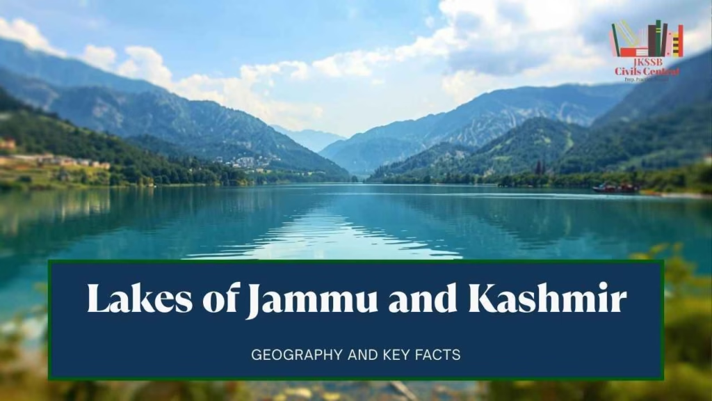
Introduction
The hydrographic landscape of the Union Territory of Jammu and Kashmir serves as a critical thematic pillar within the competitive examination framework administered by the Jammu and Kashmir Services Selection Board (JKSSB). For aspirants targeting a spectrum of posts from Junior Assistants to Accounts Assistants and Sub-Inspectors, a nuanced understanding of the region’s lentic systems is not merely an academic exercise but a strategic necessity.
The lakes of Jammu and Kashmir are characterized by their diverse geological origins—ranging from tectonic depressions to glacial scourging—and their multifaceted roles in the socio-economic, cultural, and ecological fabric of the Himalayas. These notes serves as a comprehensive technical guide, integrating historical context, limnological data, and the latest current affairs from 2024 to 2026, structured to optimize search engine visibility while maintaining the rigorous accuracy required for high-stakes examinations.
The Geological and Historical Foundations of Kashmir’s Hydrography
The origins of the Kashmir Valley’s hydrographic network are steeped in both geological evidence and local lore. According to the Nilamata Purana, the valley was once a gargantuan lake known as Satisar. Geological findings corroborate this to an extent, suggesting that the valley was a lacustrine basin formed during the Pleistocene epoch, which eventually drained due to tectonic upheavals or volcanic actions that cleared the Baramulla gorge. This ancient heritage is reflected in the name “Kashmir,” traditionally derived from “Kashyapmar”—the drainage of the lake by the sage Kashyapa.
Wular Lake: The Tectonic Sentinel
Wular Lake, situated in the Bandipora district, is the most significant remnant of the ancient Satisar. It holds the distinction of being the largest freshwater lake in India and one of the largest in Asia. Its origin is primarily tectonic, having been formed by the subsidence of the earth’s crust. The Jhelum River serves as its primary inflow and outflow, making the lake a critical flood-moderating basin for the entire valley.
Historical management of Wular reflects its strategic importance. In 1444, Sultan Zain-ul-Abidin commissioned the construction of an artificial island named Zaina Lank in the center of the lake to provide shelter for boatmen during the fierce, unpredictable winds that characterize the area. Modern interventions include the Tulbul Navigation Project, located at the mouth of the lake near Sopore, which was designed to maintain a minimum draught in the Jhelum to facilitate year-round navigation.
| Parameter | Wular Lake Technical Details |
| District | Bandipora |
| Surface Area | ~130 – 189 sq. km (seasonal variation) |
| Primary Inflow | Jhelum River |
| Designation | Ramsar Site (since 1990) |
| Restoration Authority | Wular Conservation and Management Authority (WUCMA) |
Dal Lake: The Cultural and Urban Nucleus
Dal Lake is arguably the most recognized water body in the Union Territory, often described as “Srinagar’s Jewel” or the “Jewel in the Crown of Kashmir”. Unlike the tectonic Wular, Dal is an urban lake that is likely a fluvial remnant or a collection of several small lakes connected by human and natural processes. It is divided into four major basins: Gagribal, Lokut Dal, Bod Dal, and Nagin, though the latter is frequently treated as an independent entity known for its tranquil surroundings and “Jewel in the Ring” sobriquet.
The lake is famous for its “Raad”—floating gardens where farmers grow vegetables and flowers on mats made of intertwined aquatic vegetation. The Mughal influence is ubiquitous, particularly in the two artificial islands, Rup Lank (Char Chinari) and Sona Lank, built to enhance the aesthetic landscape of the lake. Dal Lake is also the epicenter of Srinagar’s houseboat industry and Shikara tourism, serving as a floating economy that supports thousands of families.
| Basin Name | Distinguishing Features |
| Gagribal | Southeastern portion, known for clarity and scenic beauty |
| Lokut Dal | Home to the iconic Rup Lank (Char Chinari) island |
| Bod Dal | Large open water expanse featuring the Sona Lank island |
| Nagin | “Jewel in the Ring”; separated by a causeway, deeper and cleaner |
Limnology and Ecology of Minor Valley Lakes
Beyond the major basins of Wular and Dal, the Kashmir Valley hosts several smaller but ecologically significant lakes that are frequently mentioned in JKSSB geography questions.
Manasbal Lake: The Deepest Abyss
Located in the Ganderbal district, Manasbal Lake (Supreme Gem of all Kashmiri Lake) is consistently cited as the deepest lake in India, with a maximum depth of approximately 13 meters. The name is believed to be a derivative of the sacred Lake Manasarovar. The lake is renowned for the profusion of Lotus (Nelumbo nucifera), which bloom spectacularly in July and August. Overlooking the lake is the Nur Jahan-commissioned “Jarokha Bagh” (Mughal Garden), which provides a panoramic view of the basin.
Anchar, Khushal Sar, and Gil Sar
The Anchar Lake, situated near the Soura area of Srinagar, is hydrologically connected to Dal Lake via the Amir Khan Nallah. It serves as a critical wetland for flood regulation but has suffered significantly from urban encroachment and pollution. Khushal Sar and Gil Sar are smaller urban lakes in Srinagar that have become highly deteriorated due to siltation and sewage discharge, yet they remain vital components of the city’s ancient inland waterway system.
Harwan Lake (Harwan Reservoir)
It is Located in Harwan Village, Srinagar. It is situated about 19 km from the city center (Lal Chowk).In official records, it is classified as a reservoir rather than a natural alpine lake. It was constructed during the late 19th century (specifically under the reign of Maharaja Pratap Singh) to supply filtered water to the city of Srinagar.It serves as the primary gateway to the Dachigam National Park.
Sharab Kul (The Canal)
The Sharab Kul is a famous historical canal that originates from the Harwan Lake/Reservoir. In administrative and historical texts, it is described as the canal that carries water from Harwan to the Shalimar Garden and other parts of the city. It was engineered to maintain the fountains and the “char-chinar” aesthetics of the Mughal Gardens, while also providing irrigation and drinking water.
Nagat Nambal:
- Official Location: It is situated in the Nowshera/Zakir Nagar area of Srinagar, near the interface of the city’s northern urban sprawl and the foothills of the Zabarwan range.
- Definition of “Nambal”: In Kashmiri, the word Nambal refers to a wetland, marsh, or a shallow lake that often fluctuates in size depending on the season and rainfall.
- Hydrological Role: Historically, Nagat Nambal acted as a natural sponge and reservoir. It helps regulate the water levels of the surrounding areas and filters the runoff from the nearby mountains before it enters the city’s canal system.
- Ecological Status: Much like Brari Nambal and Khushal Sar, Nagat Nambal has faced significant ecological challenges over the decades. Official environmental reports often cite it as being under stress due to:
- Encroachment: Urban expansion and land filling.
- Siltation: Natural and human-induced accumulation of sediment.
- Trophic Status: It is considered Eutrophic, meaning it is nutrient-rich but often suffers from excessive weed growth and low water clarity compared to alpine lakes like Tarsar.
High-Altitude Alpine Lakes: The “Great Lakes” of J&K
The upper reaches of the Himalayas in Jammu and Kashmir are dotted with oligotrophic, high-altitude glacial lakes. These bodies of water are characterized by extremely low nutrient levels, high transparency, and a reliance on snowmelt for their hydrological balance.
The Twin Sisters: Tarsar and Marsar
Tarsar and Marsar are two almond-shaped alpine lakes located in the Aru region of the Anantnag district. They are separated by a mountain with a peak elevation exceeding 4,000 meters and are affectionately known as the “twin sisters”. Interestingly, these lakes drain in opposite directions: Tarsar flows into the Lidder River at Lidderwat, while Marsar drains toward the Dachigam National Park side. The basin surrounding these lakes is a sanctuary for rare wildlife, including the critically endangered Kashmir Stag (Hangul), Ibex, and the Himalayan Brown Bear.
(Note: While Tarsar is geographically and culturally tied to the Anantnag district (specifically the Aru Valley/Pahalgam region), the lake itself falls under the administrative jurisdiction of the Tral Tehsil in Pulwama.)
Gangabal: The Sacred Source
Situated at the foot of Mount Harmukh in Ganderbal, Gangabal Lake is also known as “Harmukh Ganga”. It is one of the most sacred sites for Kashmiri Hindus, who consider the lake to be an abode of Lord Shiva and use it for ancestral rites, similar to Haridwar. The lake is the traditional source of the Sind River and is famous for its population of Brown Trout, attracting anglers from across the globe.
Gadsar: The Lake of Flowers and Death
Gadsar Lake, or “Gad Sar” (Lake of Fishes), is located in the Bandipora district. It is often referred to as the “Valley of Flowers” due to the lush alpine meadows that surround it during the summer. However, it also carries the ominous name “Yem Sar” or “Lake of Yama,” based on unresolved local myths that link the lake to the deity of death. The lake is accessible via high-altitude tracks from Naranag or Sonamarg, crossing the Nichnai and Gadsar passes.
| High Altitude Lake | District | Elevation (m) | Sobriquet/Sacred Value |
| Gangabal | Ganderbal | 3,576 | Harmukh Ganga; Abode of Shiva |
| Sheshnag | Anantnag | 3,590 | Named after the King of Nagas; Amarnath route |
| Kausar Nag | Kulgam | 3,500+ | Vishnupad; Source of Veshav River, Also Known as Kramasara in Nilmat Purana. |
| Vishansar | Ganderbal | 3,710 | Lake of Vishnu; Source of Kishanganga(Neelam) |
| Krishansar | Ganderbal | 3,800+ | Neighbor to Vishansar; known for trout |
| Nilnag | Budgam | 2,180 | Blue Water Lake; near Yusmarg |
| Lake Type | Trophic Status | Description | Examples |
| Oligotrophic | Tarsar / Marsar | Low nutrients, high clarity, very deep/cold. | High-altitude alpine lakes. |
| Mesotrophic | Mansar (partially) | Moderate nutrients, clear water but with some submerged plants. | Mid-altitude lakes. |
| Eutrophic | Dal Lake / Surinsar | High nutrients, high algae/weed growth, lower clarity. | Urban or lowland lakes with human impact. |
Lakes and Wetlands of the Jammu Division
While the Kashmir Valley is renowned for its alpine basins, the Jammu division possesses unique water bodies that are vital to the region’s ecology and religious heritage, particularly within the semi-arid Shiwalik range.
Mansar and Surinsar: The Sacred Twins
Located in the Jammu and Samba districts, Mansar and Surinsar are twin lakes with a shared mythological origin. According to Hindu legend, the lakes were formed when Babruvahana(Son of Arjuna, the hero of the Mahabharata,) shot an arrow into the ground at Mansar; the arrow pierced the earth and emerged at Surinsar, creating a spring.
Mansar is a major pilgrimage site where devotees perform “Mundan” (first hair cut) ceremonies and newlywed couples conduct “Parikrama” (circumambulations) around the lake to seek the blessings of Sheshnag, the serpent god. Surinsar, located about 30 km away, is equally picturesque and surrounded by thick mangroves and pine forests. Together, they form the Surinsar-Mansar Wildlife Sanctuary, which supports species like the Spotted Deer, Neelgai, and a variety of seasonal waterfowl.
Sanasar and Others
Sanasar, located near Patnitop in the Ramban district, is a cup-shaped meadow featuring a small lake. It is a popular destination for paragliding and golf, often referred to as a “satellite resort” of Patnitop. Other notable water bodies in the Jammu division include the reservoir of the Baglihar Dam on the Chenab and the various small lakes in the high-altitude regions of Kishtwar and Rajouri, such as Nandan Sar and Kal Dachni.
Ramsar Sites and Wetland Conservation in J&K
Wetlands in Jammu and Kashmir are of international significance, providing essential ecosystem services such as carbon sequestration, flood control, and habitat for migratory birds. As of 2025-2026, the list of Ramsar sites (Wetlands of International Importance) in the UT has expanded significantly.
Current Ramsar Sites (2025-2026 Updated List)
- Wular Lake (1990): Designated for its role as a flood-moderating basin and its support for local livelihoods.
- Hokera Wetland (2005): Known as the “Queen of Wetlands,” it is the largest bird reserve in the valley, attracting nearly 13 lakh migratory birds annually between October and April.
- Surinsar-Mansar Lakes (2005): Recognized for their unique freshwater composite system in a semi-arid landscape and their religious value.
- Hygam Wetland Conservation Reserve (2022): A critical freshwater wetland in the Baramulla district.
- Shallbugh Wetland Conservation Reserve (2022): Located in Ganderbal, it is the largest wetland in the Kashmir Valley (~16 sq. km) after its recent rejuvenation.
The Montreux Record and Conservation Measures
The Montreux Record is a register of Ramsar sites where changes in ecological character have occurred or are likely to occur due to human interference or pollution. While regional authorities strive to keep J&K’s sites off this list, challenges such as eutrophication and siltation persist. Conservation projects, such as those led by the Wular Conservation and Management Authority (WUCMA), focus on dredging, de-siltation, and the removal of invasive willow plantations to restore the natural water-holding capacity of these basins.
Current Affairs and Recent Developments (2024–2026)
For JKSSB aspirants, staying updated with the latest administrative and environmental news is paramount. The 2024–2026 period has seen several landmark developments regarding the UT’s water bodies.
The Kashmir Water Metro Project (2025)
In early 2025, the Jammu and Kashmir government initiated a major project to revive the valley’s historic inland waterways. Modeled after the Kochi Water Metro, this Rs 900 crore initiative aims to introduce modern electric boat transport on Dal Lake, Nigeen Lake, and the Jhelum River. The project is designed to reduce road traffic congestion in Srinagar, curb air pollution, and restore the historic importance of the city’s water routes.
Glacial Lake Outburst Flood (GLOF) Risks
A report by the Central Water Commission (CWC) in October 2025 highlighted that glacial lakes in the Himalayan region have expanded by 9.24% over the last 14 years due to climate change. Within Jammu and Kashmir, 50 lakes have been identified as growing at a rate that elevates the risk of GLOFs—sudden, violent floods caused by the breach of moraine dams. Continuous monitoring using high-resolution Sentinel satellite data is now a priority for disaster management authorities in the region.
Administrative and Budgetary Highlights (2025)
The 2025–26 J&K UT budget, presented in March 2025, allocated significant funds for the “Integrated Agriculture Development Program” (HAPD) and environmental sustainability. This period also saw the appointment of the first Chief Minister after seven years of direct central rule, signaling a new phase in the governance of the region’s natural resources. Furthermore, the “Digital Tree Aadhar” initiative was launched by the Forest Research Institute to monitor the health of Chinar trees, some of which line the iconic banks of the valley’s lakes.
Examination Strategy: Master Table of J&K Lakes
To assist JKSSB aspirants in last-minute revisions, the following table consolidates critical data points frequently asked in previous year papers.
| Lake Name | District | Unique Fact / Sobriquet | Key Project / Project Site |
| Wular Lake | Bandipora | Largest freshwater lake in India | Tulbul Navigation Project |
| Dal Lake | Srinagar | “Jewel in the crown of Kashmir” | Char Chinari (Rup Lank) |
| Manasbal Lake | Ganderbal | Deepest lake in India (13 m) | Jarokha Bagh (Mughal Garden) |
| Mansar Lake | Samba/Jammu | Mythological Arjuna connection | Sheshnag Shrine |
| Gangabal Lake | Ganderbal | “Harmukh Ganga”; Sacred to Hindus | Harmukh Mountain foothills |
| Gadsar Lake | Bandipora | “Lake of Fishes”; “Yem Sar” | Valley of Flowers |
| Sheshnag Lake | Anantnag | En route to Amarnath Cave | Named after King of Nagas |
| Kausar Nag | Kulgam | “Vishnupad”; Source of Veshav River | Snow-fed alpine lake |
| Tarsar Lake | Anantnag | Almond-shaped; twin of Marsar | Drains into Lidder River |
| Nagin Lake | Srinagar | “Jewel in the Ring” | Causeway separation from Dal |
Conclusion and Strategic Recommendations
The study of Jammu and Kashmir’s lakes is a multi-dimensional endeavor that requires aspirants to synthesize geographical facts with historical legends and contemporary environmental policies. From the tectonic origins of Wular to the sacred depths of Gangabal and the modern infrastructure of the Srinagar Water Metro, these water bodies are central to the Union Territory’s identity.
For optimal performance in JKSSB examinations, candidates should prioritize understanding the hydrological links between these lakes and major rivers (e.g., Jhelum’s flow through Wular). Furthermore, a deep familiarity with the Ramsar Convention and the specific ecological threats like eutrophication and GLOFs will provide a competitive edge in the “Environmental Science” and “Current Affairs” sections of the syllabus. By utilizing this compendium, which is verified against government data and updated to include 2026 developments, aspirants can ensure high accuracy and a comprehensive grasp of this vital subject area.